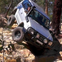
Newnes SF / Zig Zag - Track Locations
SOUTH/WEST REGION
.
-------------- UPDATE --------------
National Parks are taking over this region, gates are likely inbound.
Some GPS locations have been removed, stay tuned for updates.
------------------------------------------
.


Comments
SOUTH/EAST REGION
Bald Hill Trig Point [EASY]:
Air Vent [EASY]:
No image - Click here for more details
Nine Mile Steps and cave [VERY DIFFICULT]:
Nine Mile, Bungleboori Creek view [EASY]:
Moto region loop [MEDIUM]:
Farmers Creek track and view [VERY DIFFICULT]:
Farmers Dam view [EASY]:
Farmers Dam access track [RESTRICTED?]:
No image - Click here for more details
CENTRAL REGION
Main mud flats [EASY/DIFFICULT]:
Bungleboori Picnic Area [EASY]:
Powerline track [DIFFICULT]:
Moon Rock / Slippery Rock [VERY DIFFICULT]:
Lost City #1, main (north/east) [EASY]:
Lost City #2, Opposite (south side) [DIFFICULT]:
Lost City #3, north/west side [MEDIUM]:
Lost City #4, far north/west side [EASY]:
Lost City #5, south/west by the Military Fence [EASY]
Ranger Bob's track [MEDIUM/DIFFICULT]:
Underground mines venting area [EASY]:
NORTH/EAST REGION
Bounty Hill [VERY DIFFICULT]
Right Turn Gully [EASY/MEDIUM]
Axle Hill [DIFFICULT]:
Axle Hill View [EASY]:
No Photo - click for details
Deep Pass camp ground [WALK IN ONLY]:
NORTH/WEST REGION
Blackfellows Hand trail [EASY]:
Sunnyside lookout (view over the Wolgan Valley) [EASY]:
Birds Rock [EASY]:
Carne Creek gorge [EASY]:
Spanish Steps [DIFFICULT]:
FAR NORTH REGION
(There are outside of the Newnes State Forest region, but near enough to include here)
Baal Bone Gap [MEDIUM]:
Baal Bone, Wolgan Valley view #1 [EASY]:
Baal Bone, Wolgan Valley view #2 north [EASY]:
Baal Bone, Park on a Cliff Edge:
No Photos - click to see details
(reserved)
(reserved)
(reserved)